“Is San Diego a border city?” Derrik Chinn asked the 25 of us who set off with him on his Tijuana tour bus last Saturday morning. My first thought, like many of my fellow passengers, was sure. We live on the line separating the US from Mexico, as a glance at any map will confirm. But Derrik pressed, and we had to agree that many San Diegans rarely give a thought to the actual, physical geopolitical boundary. In contrast, Derrik pointed out that if you asked any Mexican the same question about Tijuana, he or she would think you were crazy. In Tijuana, no one’s unaware of their proximity to la linea. Derrik wasn’t moralizing. I think his point was just to remind us that for different folks, the border can feel very different.
For a clearer understanding of the past and current physical barrier between San Diego and Mexico, Derek developed his new tour; he calls it “Against the Wall.” He was giving it for the first time Saturday. A former Union-Tribune staffer, Derek moved to Tijuana 10 years ago and eventually started an offbeat tour company (Turista Libre). Steve and I have gone on several of his outings over the years and found them all to be exceptional, but the wall tour was the best yet.
We met at the Pedwest border crossing. It just opened 6 months ago, and Steve and I hadn’t had an opportunity to cross there yet. We were impressed by not just its pristine condition but also by how much closer it delivers visitors on foot to Tijuana’s commercial center.


Once across, we boarded Derrik’s vehicle, which he rents out during the week to serve as a TJ city bus.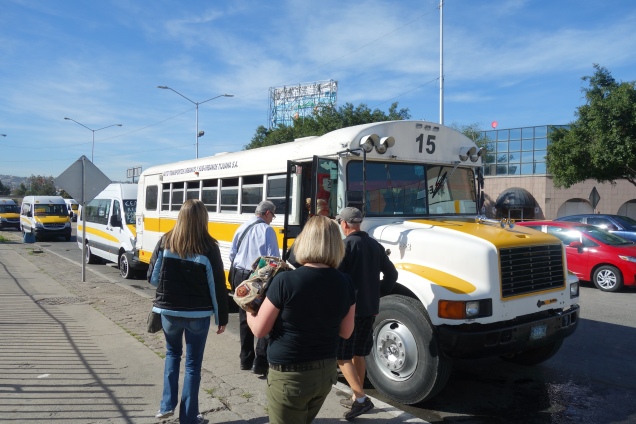
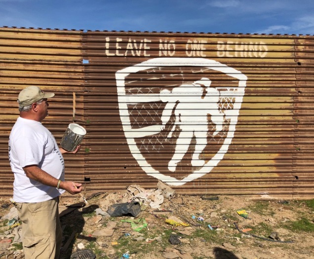
Our first stop was in the far northeastern part of the city, beyond the Otay Mesa border crossing. We had to bump for a bit down a dirt road through a largely industrial area to arrive at the area offering the best views of the prototypes for President Trump’s “big, beautiful wall” that were built last fall. Access to them on the north side of the border is strictly limited. But from the south, their 30-foot height makes them easy to see.
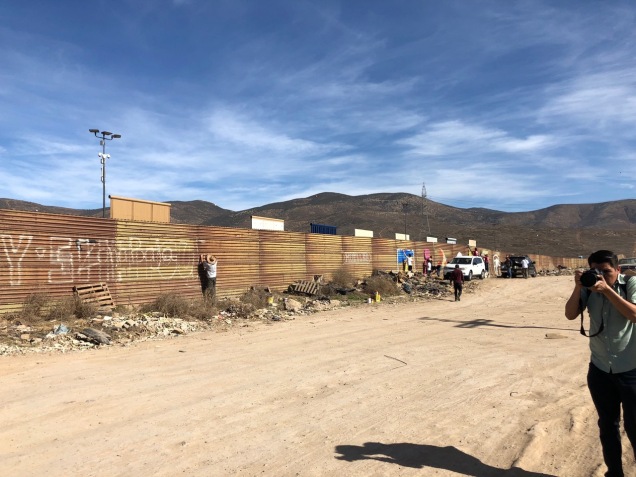
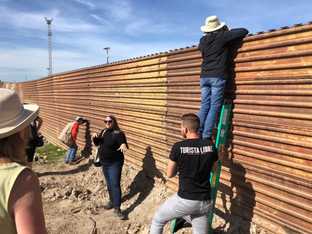

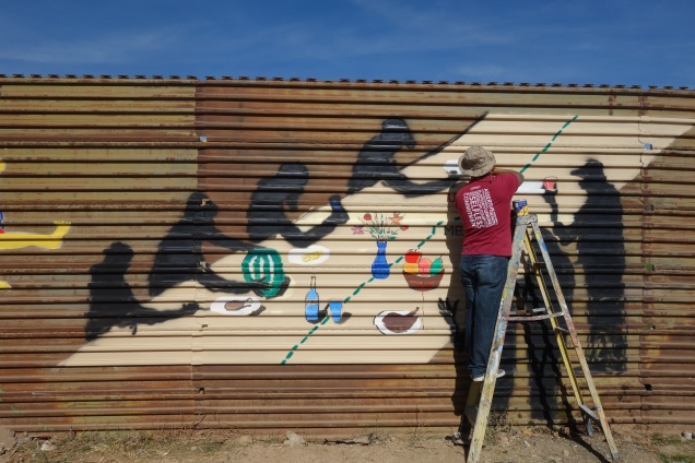
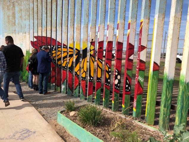
The prototypes make the area north of the border look like a theater set. Jill says some folks have suggested they be left in place permanently, as a sort of a monument. Other art work was unfolding in the moment. A number of folks were using the corrugated iron as a canvas.
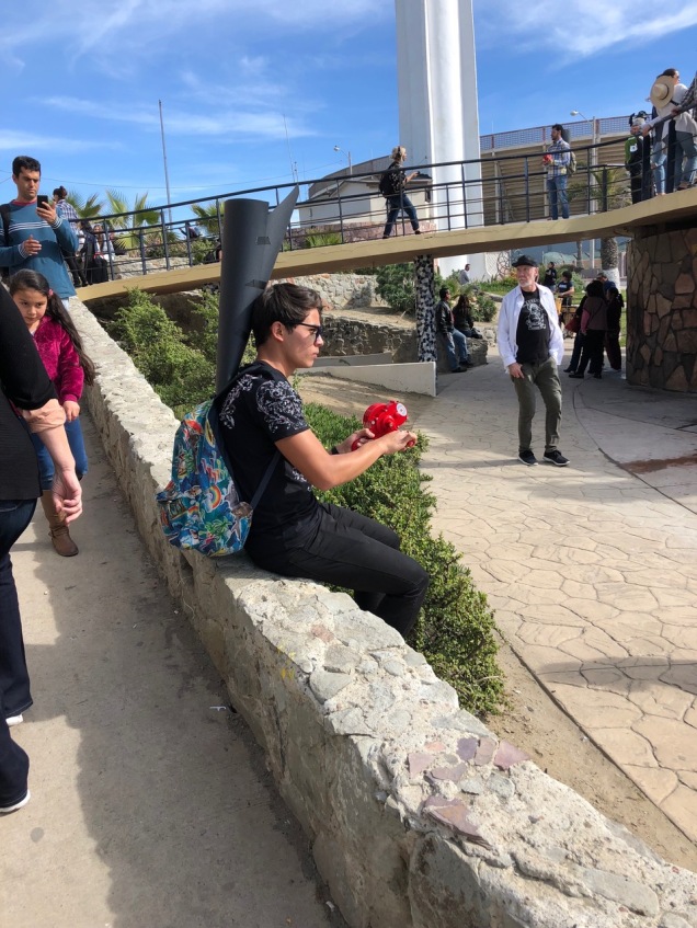
It was all very interesting, but we had to hustle back on the bus and drive to the beach. We were trying to get there in time for an extraordinary event taking place on both sides of the fence: a special binational percussion performance by about 70 American and Mexican musicians.
We arrived late and found the concert in progress at full volume. A wild cacophony of drums and other booming instruments were crashing and thumping.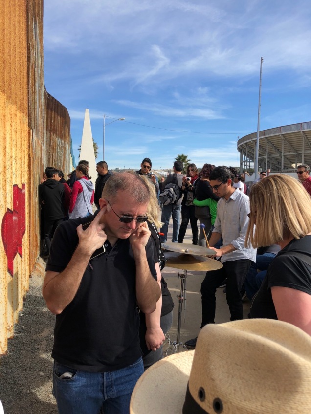
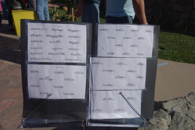
I found it hard to tell at first if the players were organized, but soon we realized that many musicians were following a printed score.
 Gradually, the riotous sounds gave way to muted waves of chimes, gongs, and cymbals.
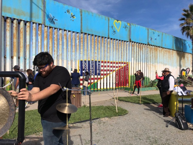
We could hear some musicians playing on the north side of the barrier, but it was hard to see much, other than the presence of a half-dozen or so percussionists in the no-man’s-land known, ironically, as Friendship Park. (The Border Patrol only allows a handful of folks to enter it at any time. Most of the American spectators had to stay on the far side of the second fence there.)
But on the Mexican side, we mingled with a jolly crowd. 
Again, it was tempting to linger, but Derrik herded us back on the bus again. Our next destination was the wonderful Telefonica gastropark, near the center of town. We stayed for more than an hour (three tacos and a craft beer were included in the tour price.) That place is worthy of a blog post all its own. But I’ll gloss over it now, to jump to our final border interaction of the day: another of the little-appreciated 276 “border monuments” that extend all the way from the Pacific Ocean to Ciudad Juarez.
Like most of the monuments, Monument 254 is made of metal, and like all of the monuments it stands on US soil. Both countries long ago agreed to share the annual maintenance work.
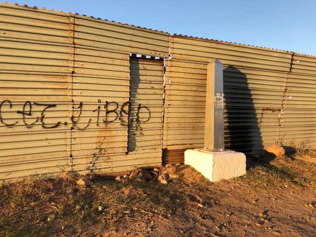
This monument was in Colonia Libertad, an old neighborhood just west of the fence surrounding Tijuana’s international airport. 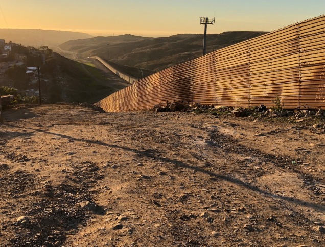
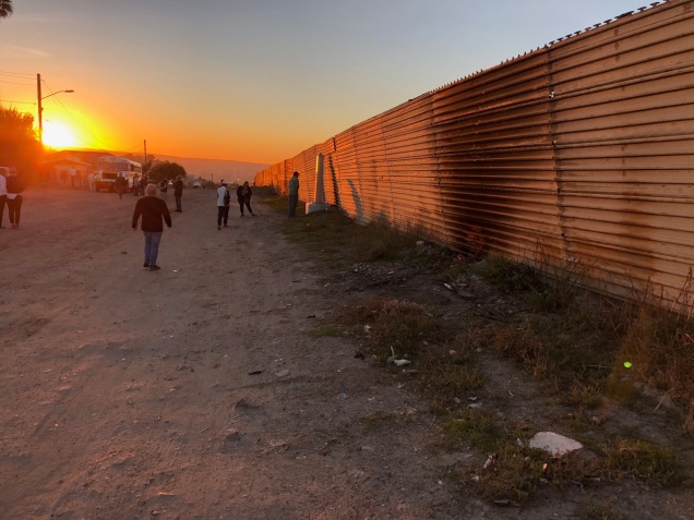
People’s houses, lower middle-class-looking to my eye, crowd up close to the border fence here. As we strolled along, roosters crowed and snatches of norteño music floated by on the breeze. A few locals ambled past us, but not many. It seemed a time to be home relaxing, near sundown on a Saturday with perfect weather in January.
Most of us eventually drifted east along the fence for a while, in the direction of the airport. Across the street stands a bigger public artwork, a giant border monument. If the meaning of the crosses sticking out of it was unclear… 
…the ones affixed to the actual fence left no doubt.
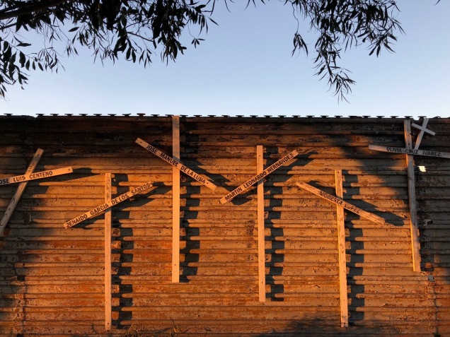
- They mark the passing of some of the individuals who have died, trying to make their way north.
For all of us on the tour, though, that passage was both safe and easy. We boarded the bus, were dropped off next to the pedestrian crossing, and by-passed the long line (at least those of us with SENTRI passes did). The immigration officer didn’t ask me if I had anything to declare. Had he done so, I could have told him about the hunk of excellent sun-dried-tomato-studded cheese I bought at the gastropark. And the richer mental picture I acquired of the border next door.
